Back Kaledonské hory Czech Northwest Highlands German Northwest Highlands English Northwest Highlands French Északnyugati-felföld Hungarian ノースウェスト・ハイランド Japanese Góry Kaledońskie Polish نارتھویسٹ ہائیلینڈز PNB Каледонске планине Serbian Північно-західне Шотландське нагір'я Ukrainian
58°01′08″N 4°28′26″W / 58.019°N 4.474°W

divisions of Scotland


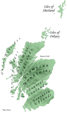
The Northwest Highlands are the northern third of Scotland, which is separated from the Grampian Mountains by the Great Glen. The Caledonian Canal, which extends from Loch Linnhe in the west, via Loch Ness to the Moray Firth in the north splits this area from the rest of the country.
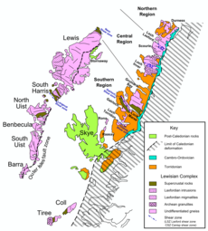
The Highlands are formed on Lewisian gneiss, the oldest layers of rock in Scotland. There are impressive rock islands of dark red or gray Torridonian sandstone which stick up out of the gneiss. Some of the peaks, such as Beinn Eighe and Canisp, are topped with light gray or white Cambrian quartzite.
The city of Inverness, known as the "Capital of the Highlands", is by far the largest settlement in the region. It is the administrative centre for the Highland Council area.
© MMXXIII Rich X Search. We shall prevail. All rights reserved. Rich X Search